
HARVEY Maps continues its quest to make maps that are relevant to and meeting the needs of hikers.
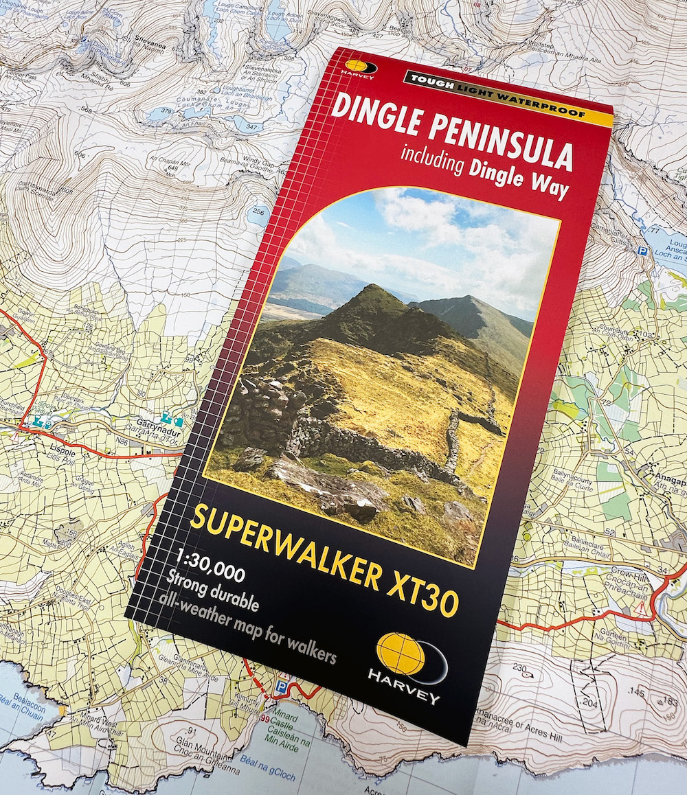
As such it has just published a Superwalker map for the Dingle Peninsula in Ireland. The 30 mile (48km) route has everything from beaches and cliffs to rolling hills including the 952m Mount Brandon.
The result is a mapping-first, producing one meticulously detailed map that covers the entire Dingle Peninsula, featuring the renowned Dingle Way. It also, uniquely, includes the Blasket Islands, an area historically not featured on a map of the area. This new map is available now priced at £14.50 and at select retailers.
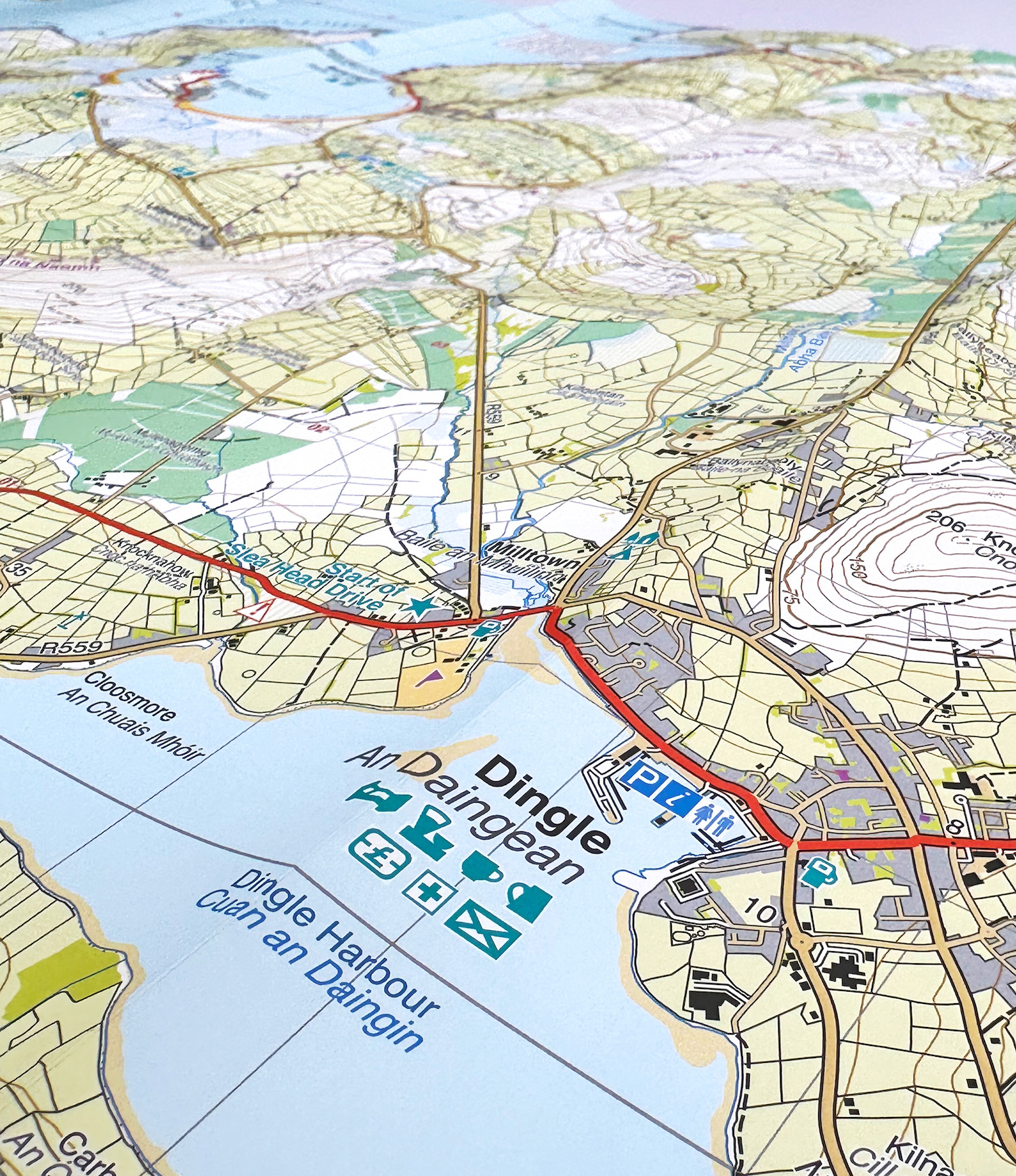

Above from L to R: It’s a 1:30,000 scale, close up of Dingle, inset map of the Blasket Islands at 1:50,000 scale
Don’t feel foolish if you’ve not heard of the Dingle Peninsula, but it’s been gaining huge interest thus highlighting the demand for a reliable map of the area. The official tourism website is here.
Macs Adventure is a leading self-guided walking, cycling, and active adventure company, that offers guided walks along the Dingle Peninsula. Neil Lapping, Founder & CEO says: “In 2023, we’ve witnessed an impressive 45% increase in bookings compared to the previous year, spanning both our classic Dingle Way itineraries and our new Slower Adventure tours. This trail unquestionably stands as Ireland’s most iconic.”
Producing the map came with its challenges and took HARVEY Maps six months to bring the map to life.
Photogrammetry: All of the data is painstakingly drawn (plotted) by HARVEY Maps’ team of photogrammetrists, and there is always a wealth of detail to capture. For a peninsula such as Dingle, accuracy is crucial when interpreting on the photos the difference between farmland and rough pasture as well as identifying coastline features consistent with the high tide line.
Cartography and data editing: External contributors were used to guarantee that both English and Gaelic text was accurately recorded. Since most placenames in the area have two versions the map was in danger of becoming text-heavy and cluttered. The cartographers worked tirelessly to clearly display the text without obscuring the physical data underneath. Dense networks of field boundaries, streams and individual houses extended the time it took to edit the data to ensure clarity.
Outdoor access: Ireland doesn’t have the same legal framework for outdoor access as the UK, without either a right-of-way network as in England and Wales, or a general right to roam like in Scotland. In-depth research was undertaken to establish where hills and coasts could be accessed without issue.
Survey: Apart from the main tourist traverse of Mt Brandon, the higher hills are generally pathless and very rough with thick tussocks of heather and grass, peat bogs, turf cutting, etc., so the daily distance each surveyor was expected to cover had to take this into account.
Layout: The Dingle Peninsula is a large landform, with lots of further peninsulae and headlands that jut out into the sea. Even at 1:30,000, this presented a challenge in terms of fitting it on a standard Superwalker map. The team cleverly created one map by showing the eastern section of the Peninsula (the Slieve Mish Mountains and the section of the Dingle Way from Camp to Tralee) as an inset in the blank corner left by the diagonal coastline from Sybil Point to Brandon Point.
Beehive huts: these mediaeval monastic cells pepper the landscape around Slea Head but are too small to show as boundaries or buildings. HARVEY Maps designed a new symbol, a green circle with white outline, to indicate the positions of these points of historical interest.
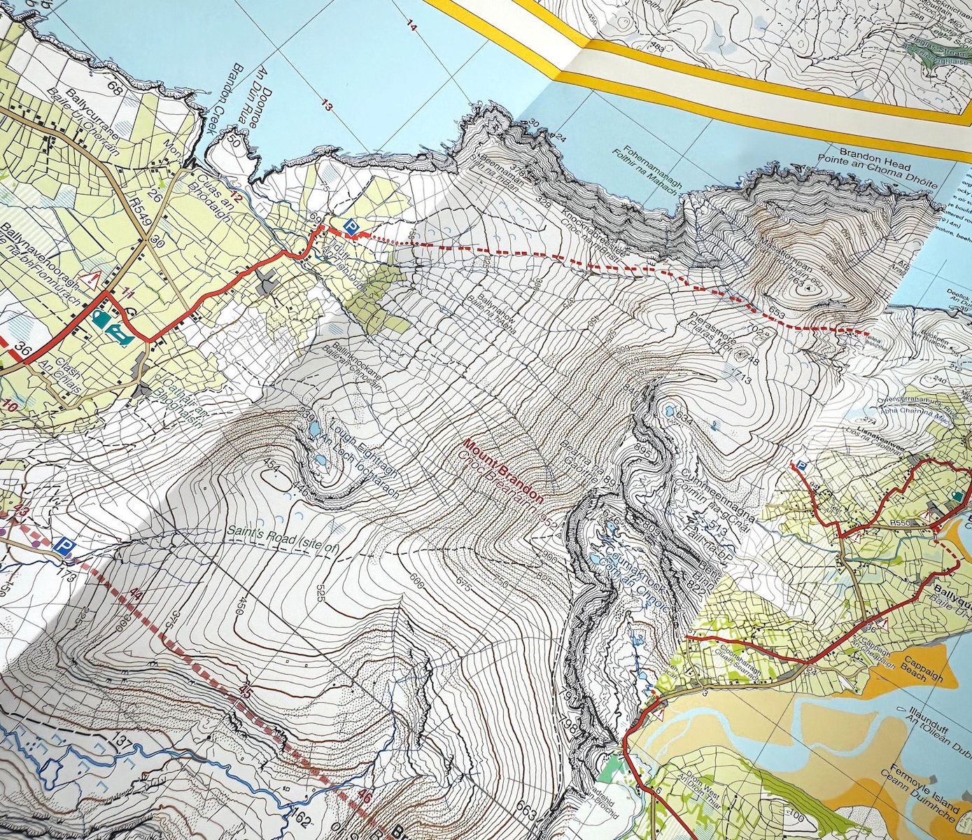
Close up of the 952m high Mount Brandon
Key features of the new HARVEY Maps Superwalker XT30:
Comprehensive coverage: One map using a 1:30,000 scale that covers the entire Dingle Peninsula, including mountain ridges, the Dingle Way and the much-visited Basket Islands as opposed to existing maps that use a 1:25,000 across three maps. A mapping first.
Detailed Topography: HARVEY Maps’ unrivalled attention to detail ensures all geographical features, including mountains, valleys, rivers, lakes, archaeological sites, walls and fences in farmland, are accurately represented in a clear and uncluttered way, aiding hikers in planning their routes. Not forgetting pubs and cafes for essential refreshments along the way. Placenames are offered in English with accurate Gaelic translations.
Dingle Way and Blasket Islands: The map clearly features the Dingle Way with its 179-kilometre long-distance walking route with key facilities clearly marked. The map uniquely includes an inset map of the Blasket Islands at 1:50,000 scale.
Weatherproof, lightweight and durable: Weighing just 60g (far less than half the weight of a laminated map), it has been crafted from waterproof and tear-resistant material to withstand the rigours of outdoor adventures.
Buy from www.harveymaps.co.uk
(Editors note: Be sure to check out the other Superwalker maps that HARVEY Maps makes here.